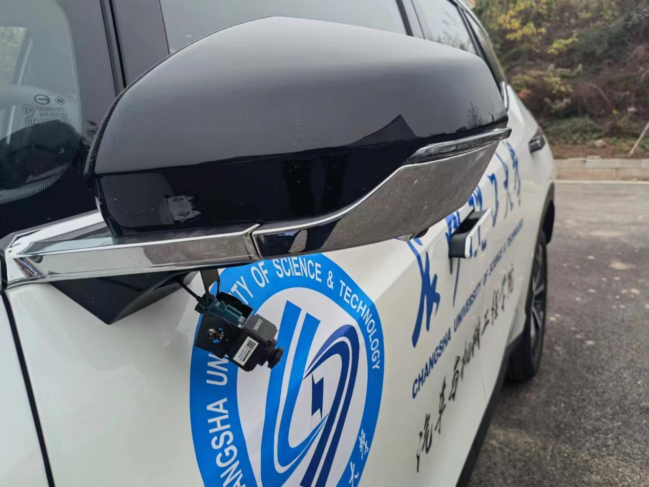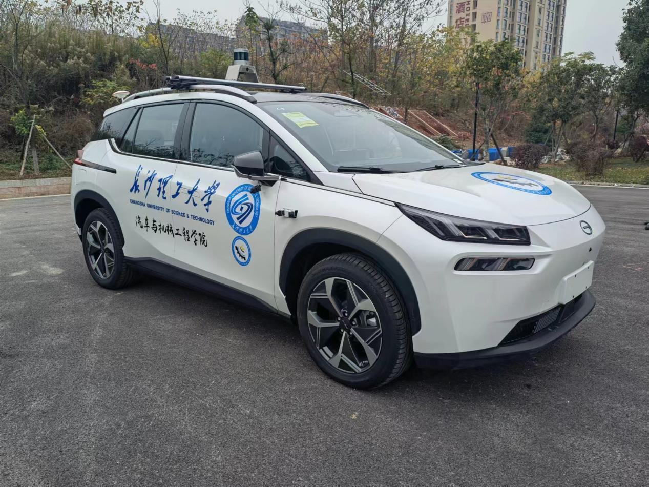
The modified real vehicle is equipped with LiDAR, IMU, a multi-camera vision system, and an autonomous driving industrial controller, supporting autonomous driving tests, data acquisition, AEB tests, and active pre-tensioning seatbelt tests.
| Overall vehicle dimensions (L × W × H) | 4786 × 1935 × 1685 mm |
| Wheelbase | 2920 mm |
| Front overhang | 926 mm |
| Rear overhang | 940 mm |
| Minimum ground clearance | 150 mm |
| Tire specification | 245/50 R20 |
| Steering gear ratio | See AION LX parameter document |
| Maximum speed | D gear: 120 km/h, R gear: 40 km/h |
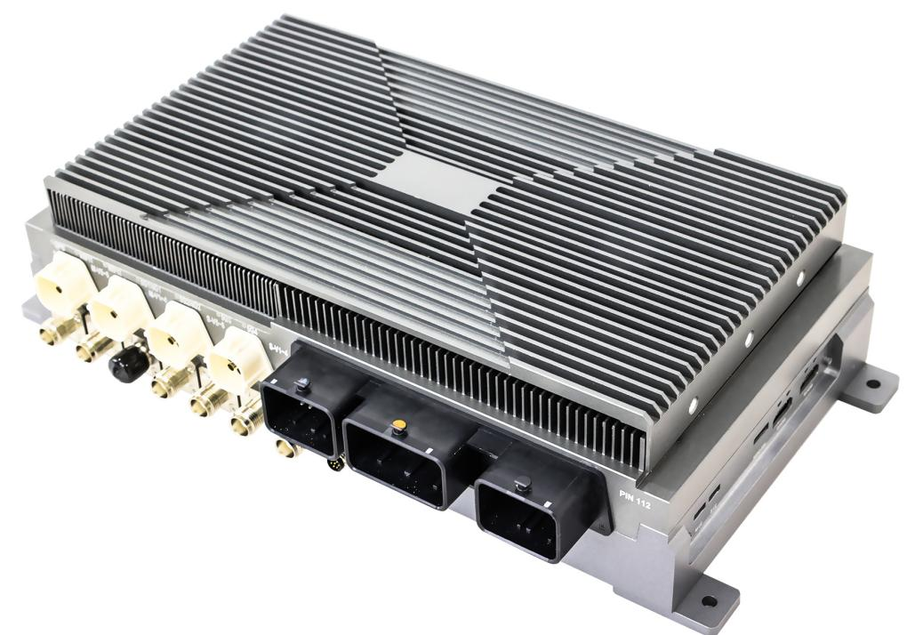
The Tianzhun GEAC91VP controller is a domain controller specially designed for autonomous vehicles, including mobile robots, robotaxis, and robobuses. It integrates two NVIDIA Jetson Xavier computing units inside and delivers computing capabilities for multi-sensor fusion perception, planning, prediction, decision-making, and other functions.
An Infineon automotive-grade multi-core MCU TC397 is embedded on the mainboard to execute critical tasks such as vehicle control and system state management. A built-in GPS module and CPLD chip constitute a time synchronization system, ensuring time synchronization across the entire sensing, computing, and control system.
The GEAC91VP supports sensors commonly deployed on autonomous vehicles, including GMSL cameras, LiDAR, millimeter-wave radars, and ultrasonic radars. Available in water-cooled and air-cooled versions.
| Processor | NVIDIA Jetson AGX Xavier |
| CPU | 2.2 GHz, 8-core ARM v8.2 64-bit CPU, 8MB L2 + 4MB L3 |
| AI performance | Up to 64 TOPS (32 TOPS per Xavier) |
| DL accelerator | 2× NVDLA Engines |
| Vision accelerator | 7-way VLIW Vision Processor |
| GPU | 512-core NVIDIA Volta™ GPU with 64 Tensor Cores |
| Memory | 32GB 256-Bit LPDDR4x, 137GB/s |
| Storage | 32GB eMMC 5.1 |
| Video encode | Up to 30×1080p30 (H.264) |
| Video decode | Up to 32×1080p30 (H.264) |
| Co-processor | Infineon AURIX 32-bit microcontroller TC397 |
| Co-processor CPU | 6 cores, maximum 300 MHz frequency |
| Co-processor memory | Up to 16MB program flash, up to 1MB data flash, 768KB SRAM |
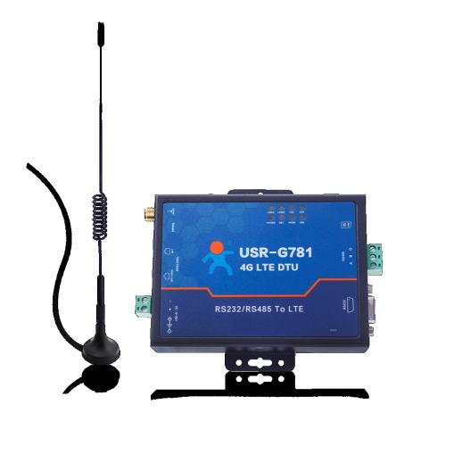
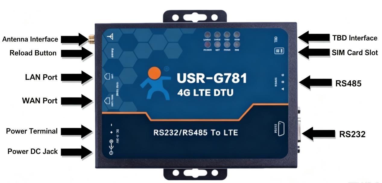
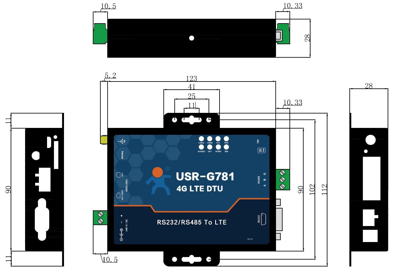
The USR-G781 is a wireless transmission device that integrates the functions of a 4G router and a 4G DTU. Combining the dual strengths of routers and DTUs, it adopts an industrial high-performance processor, multi-protected hardware interfaces, secure and stable VPN tunnels, and low-latency, high-efficiency 4G modules, meeting application requirements under harsh environments and diverse networking demands.
Featuring stability, reliability, and security, it is applicable to industrial scenarios and widely deployed in power, water conservancy, petroleum, municipal engineering, environmental protection, logistics, and other industries.
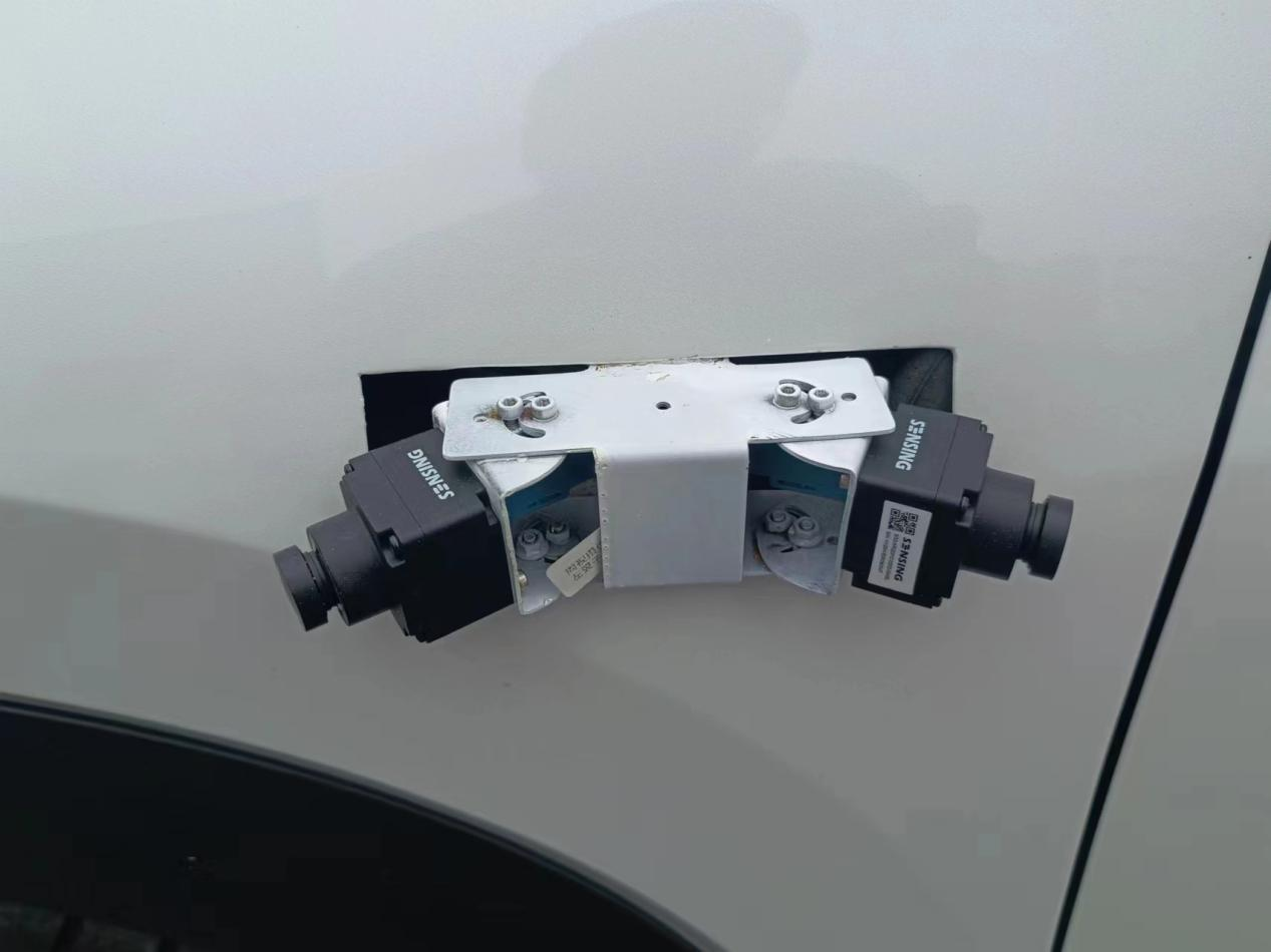
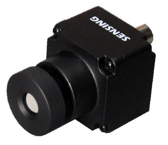
The Senyun high-performance automotive camera module is designed by Shenzhen Senyun Intelligent Technology Co., Ltd. Adopting a high-dynamic automotive-grade image sensor paired with mainstream serial transmission chips, the module delivers high reliability. Featuring broad compatibility, it can adapt to various SoC platforms.
| Sensor | ONSEMI 2.3MP AR0231 RGGB |
| ISP | AP0202 |
| Image size | 1/2.7 inch CMOS |
| Output pixels | 1920H × 1080V |
| Pixel size | 3 µm |
| Pixel type | Back Side Illuminated (BSI) |
| Frame rate | 1920×1080 / 22 fps |
| HDR range | Up to 120 dB |
| Output data | Parallel / YUV422-8bit |
| Serializer | MAXIM MAX96705 |
| Camera interface | Coaxial |
| Power supply | 5–16V POC |
| Current | < 200 mA |
| Connector | Amphenol (Z Type Fakra) |
| Operating temperature | -40°C ~ +85°C |
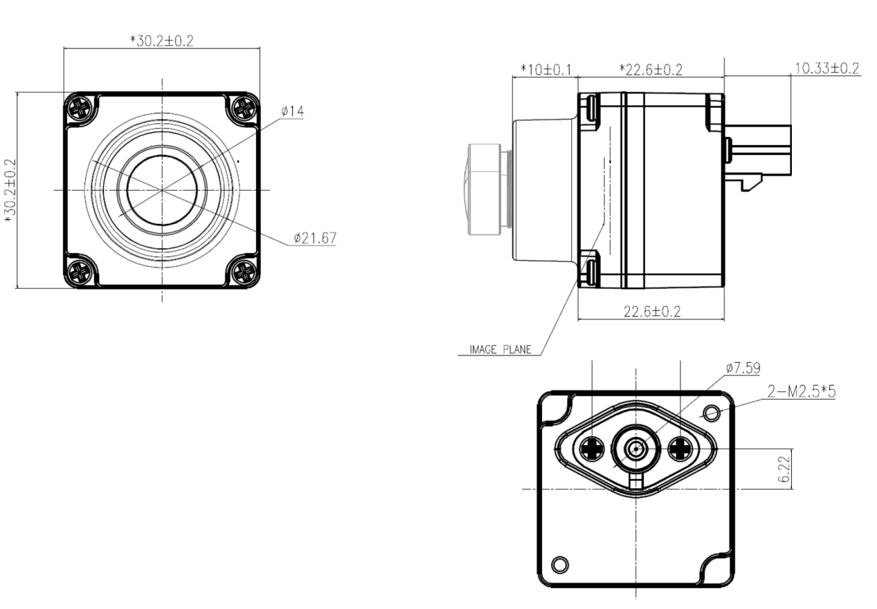
| Dimensions | W: 30mm, L: 30mm, H: 22.5mm |
| Weight | < 50 g |
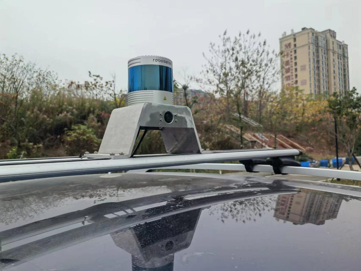
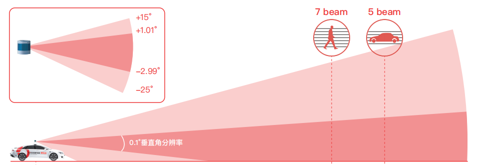
The brand-new 80-line LiDAR, RS-Ruby-80, is developed based on the RS-Ruby Plus platform. Featuring a vertical angular resolution of 0.1° and a ranging capability of 180 m @10% NIST, it fully meets the environmental perception requirements for autonomous passenger cars, trucks, buses, and mining vehicles.
Compared with the RS-Ruby Lite, the RS-Ruby-80 achieves a 50% reduction in volume, a 50% reduction in weight, and a 28% drop in power consumption, while delivering significantly improved performance and longer-range lane line detection.
| Number of lines | 80 |
| Laser wavelength | 905 nm |
| Laser safety class | Class 1 eye-safe |
| Blind zone | ≤ 0.4 m |
| Vertical field of view | 40° (−25° ~ +15°) |
| Ranging capability | 200 m (180 m @ 10% NIST) |
| Accuracy | Up to ±3 cm |
| Vertical angular resolution | 0.1° (−2.99° ~ +1.01°) |
| Horizontal field of view | 360° |
| Horizontal angular resolution | Balanced: 0.2°/0.4°; High-Performance: 0.1°/0.2° |
| Frequency / rotation speed | 10/20 Hz — 600/1200 rpm |
| Point output rate | Balanced: ~1.44M pts/s (single), ~2.88M pts/s (dual); High-Performance: ~2.88M pts/s (single), ~5.76M pts/s (dual) |
| Ethernet output | 1000M Base T1, UDP packets |
| Operating voltage | 9–32 V |
| Power consumption | Balanced: 24 W; High-Performance: 27 W |
| Weight | ~1.85 kg (excluding cable) |
| Time synchronization | $GPRMC with 1PPS, PTP & gPTP |
| Dimension | Ø125.00 mm × H128.00 mm |
| Operating / storage temperature | −40°C ~ +60°C / −40°C ~ +85°C |
| Ingress protection | IP67, IP6K9K |
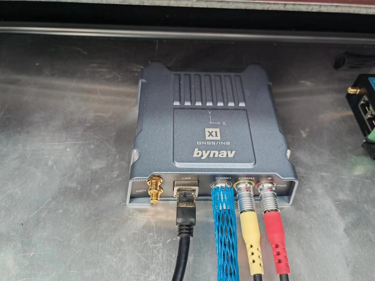
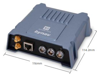
Dual-antenna RTK positioning and orientation enable GNSS+INS high-precision integrated navigation: leveraging GNSS signals received by dual antennas, this solution independently provides accurate position and attitude information, improving robustness and usability. The X1 adopts deep coupling technology combining GNSS positioning and IMU inertial measurement, outputting high-precision position, velocity, and attitude in real time.
It supports free firmware upgrades for three years, multiple interfaces (Ethernet and serial), and event-synchronized I/O for coordinated operation with other sensors such as LiDAR and SLAM systems. Optimized for vehicle applications via vehicle dynamics modeling, it handles urban road occlusions and highway signal interference, delivering continuous, stable, high-precision positioning for intelligent vehicles.
| Overall configuration | Six-system multi-frequency reception (GPS, GLONASS, BDS, BDS-3, Galileo, QZSS, NavIC) |
| Horizontal positioning accuracy (RMS) | Single point: 1.5 m; RTK: 1 cm + 1 ppm |
| Vertical positioning accuracy (RMS) | Single point: 2.5 m; RTK: 1.5 cm + 1 ppm |
| Initialization | ≤ 10 s, reliability > 99.9% |
| Maximum data rate | GNSS/RTK: 5 Hz; INS position/attitude & IMU raw data: 125 Hz |
| Time to first fix | Cold start: ≤ 60 s; Warm start: ≤ 40 s |
| Time synchronization accuracy | 20 ns RMS |
| Velocity limit | 300 m/s |
| Reacquisition after loss-of-lock | ≤ 1 s |
| Calculation latency | INS: ≤ 5 ms; RTK: ≤ 60 ms |
| Gyroscope | Range ±450 deg/s; bias stability 1.2 deg/hr; angular random walk 0.08 deg/√hr |
| Accelerometer | Range ±10 g; bias stability 16 µg; velocity random walk 0.033 m/s/√hr |
| Communication ports | 2× RS-232 (up to 921,600 bps), 1× Ethernet (10/100 Mbps), 1× CAN (1 Mbps), 1× EVENT output, 1× PPS output |
| Dimension / weight | 116 × 114.2 × 38.6 mm; 432 g |
| Power supply | +9 V ~ +32 VDC, 4.8 W |
| Operating / storage temperature | -40°C ~ +85°C / -55°C ~ +85°C |
| Ingress protection | IEC 60529 IPX7 (waterproof), IP6X (dustproof) |